Machines Built for a World Where Radio, Light, and Air Disappear
Aquatic and underwater robots are machines that travel on, beneath, or between bodies of water to observe conditions or perform work. Robotic boats map rivers and reservoirs. Tethered vehicles let pilots inspect ship hulls, reefs, pipelines, and deep seafloors while watching live video. Autonomous vehicles follow planned surveys beyond the reach of a control cable, and gliders trade speed for months of low-power measurement. Water changes nearly every familiar robotics problem. Pressure rises with depth, visible light fades, currents move the vehicle, salt attacks materials, and ordinary radio signals travel poorly. A robot must know its depth and motion without GPS once submerged, conserve energy, communicate through sound or a tether, and return data safely. These machines extend human reach, but every mission still depends on careful launch, navigation, recovery, and interpretation by people.
A: An ROV stays tethered; an AUV follows autonomous mission plans.
A: Not while submerged, so they combine other navigation methods.
A: They use tethers, acoustic modems, short optical links, or surfacing.
A: Multiple directions support hovering and precise movement around targets.
A: Its complete pressure-rated design determines the maximum safe depth.
A: Darkness, particles, color loss, and limited range constrain them.
A: They change buoyancy and glide instead of propelling continuously.
A: Manipulators, corers, suction tools, and containers preserve selected material.
A: The complete high-resolution dataset may remain onboard.
A: Begin with one measurement, controlled-water tests, and a recovery plan.
Aquatic Robotics Covers the Surface and the Depths
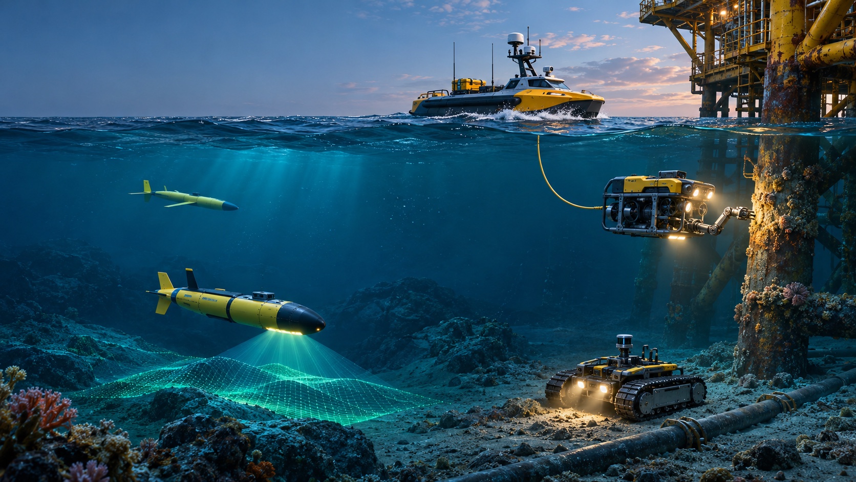
The field includes uncrewed surface vessels, remotely operated underwater vehicles, autonomous underwater vehicles, gliders, crawlers, floats, and fixed seabed stations. Some carry cameras for minutes in a harbor; others cross an ocean while measuring temperature and salinity. The category is organized less by appearance than by connection and mission. Is the robot tethered or independent? Does it cruise, hover, drift, crawl, or remain anchored? Must it return live video, touch a structure, collect a sample, or map a wide area? Those choices determine shape, propulsion, power, sensors, and support.
Water Changes Movement
A submerged vehicle experiences buoyancy and drag in every direction. Designers balance weight with displaced water so the robot sinks, floats, or remains nearly neutral. Thrusters provide forward, vertical, and sideways control, while fins steer efficient torpedo-shaped vehicles.
Currents can push a hovering robot away from a target and consume energy. Tethers add drag. A stable design places mass and buoyancy so the vehicle naturally returns upright. Movement planning always includes the water itself.
Pressure Defines the Depth Limit
Pressure increases quickly below the surface. Housings protect electronics, batteries, cameras, and connectors from water and crushing force. Deep vehicles use strong metal or composite pressure vessels, oil-filled components, pressure-tolerant electronics, and buoyancy materials that resist compression. A seal that works in a pool may fail after repeated deep cycles. Designers test housings and penetrations beyond intended depth, inspect them between missions, and track fatigue. Depth rating applies to the complete assembled vehicle, not merely its strongest container.
ROVs Keep a Live Connection
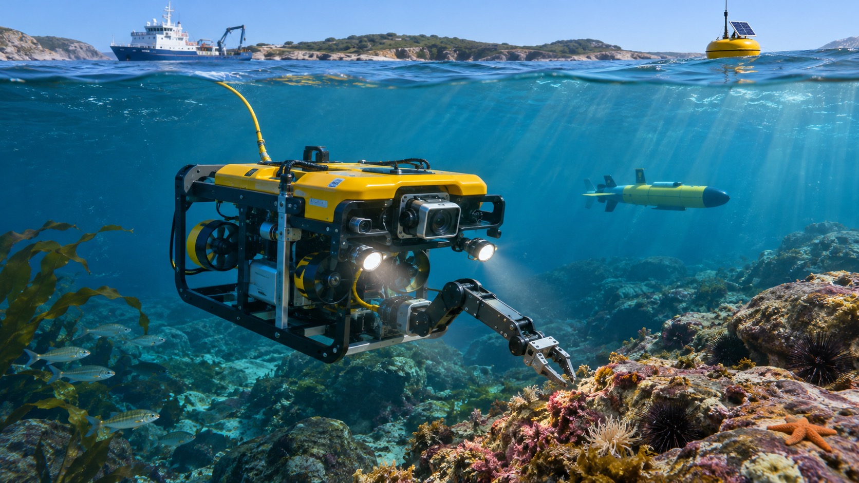
A remotely operated vehicle, or ROV, connects to an operator through a tether. The cable carries commands, video, data, and often power from a ship or shore. Pilots can hover, inspect closely, operate manipulators, and respond immediately.
The tether enables rich communication but can snag, twist, and pull the vehicle. A management system pays cable out near the work area. ROV missions require pilots, deck crew, launch equipment, and a support platform appropriate to the sea state.
AUVs Survey Without a Control Cable
An autonomous underwater vehicle follows a programmed route using onboard navigation and decision rules. Without tether drag it can cover long transects, fly close to the seabed, and enter areas difficult for a ship-connected vehicle. Sonar, cameras, chemical sensors, and water instruments record data internally. Communication underwater is limited, so the AUV handles routine navigation, obstacle response, and energy management itself. It may surface periodically for GPS and satellite contact. Recovery is a major mission phase: the most valuable data may remain inside until the vehicle is safely aboard.
Gliders Turn Buoyancy Into Long Endurance
Underwater gliders change buoyancy to rise and sink, then use wings to convert vertical movement into slow forward travel. They consume little energy compared with continuous propellers. Repeated dives create a sawtooth path that samples broad ocean regions for weeks or months.
Gliders carry modest payloads and cannot hold position in strong currents. They surface to obtain GPS and transmit summaries. Their strength is persistent observation rather than close inspection or heavy work.
Surface Robots Link Water and Sky
Uncrewed surface vessels use propellers, sails, waves, or solar power to travel rivers, lakes, coasts, and oceans. GPS and radio or satellite communication are available at the surface. These robots map depths, sample water, monitor weather, inspect ports, or serve as relays for submerged vehicles. Waves, traffic, fishing gear, ice, and shorelines complicate navigation. Maritime rules and visible markings remain important even without a person aboard. Some surface vessels operate from a nearby crew; others travel remotely for months.
Underwater Navigation Uses Several Imperfect Clues
GPS signals do not penetrate seawater. A robot estimates motion with inertial sensors, compasses, depth sensors, water-speed measurements, and acoustic references. Doppler velocity logs measure movement relative to the seabed or water. Sonar and cameras can match terrain.
Small errors accumulate into position drift. Surfacing restores GPS when possible. Ships or fixed transponders provide acoustic locations. Mission planners choose the combination that matches depth, accuracy, duration, and cost.
Acoustic Communication Replaces Ordinary Radio
Sound travels farther underwater than radio, so acoustic modems exchange short commands, status, and data. Bandwidth is low and delays can be significant. Noise, reflections, temperature layers, and distance affect reliability. Robots cannot stream unlimited video acoustically; they summarize findings and store full records. Tethered systems avoid this limitation but sacrifice freedom. Optical communication can send more data over short clear-water distances. Good missions decide which information must arrive immediately and which can wait until recovery.
Sonar Reveals What Cameras Cannot
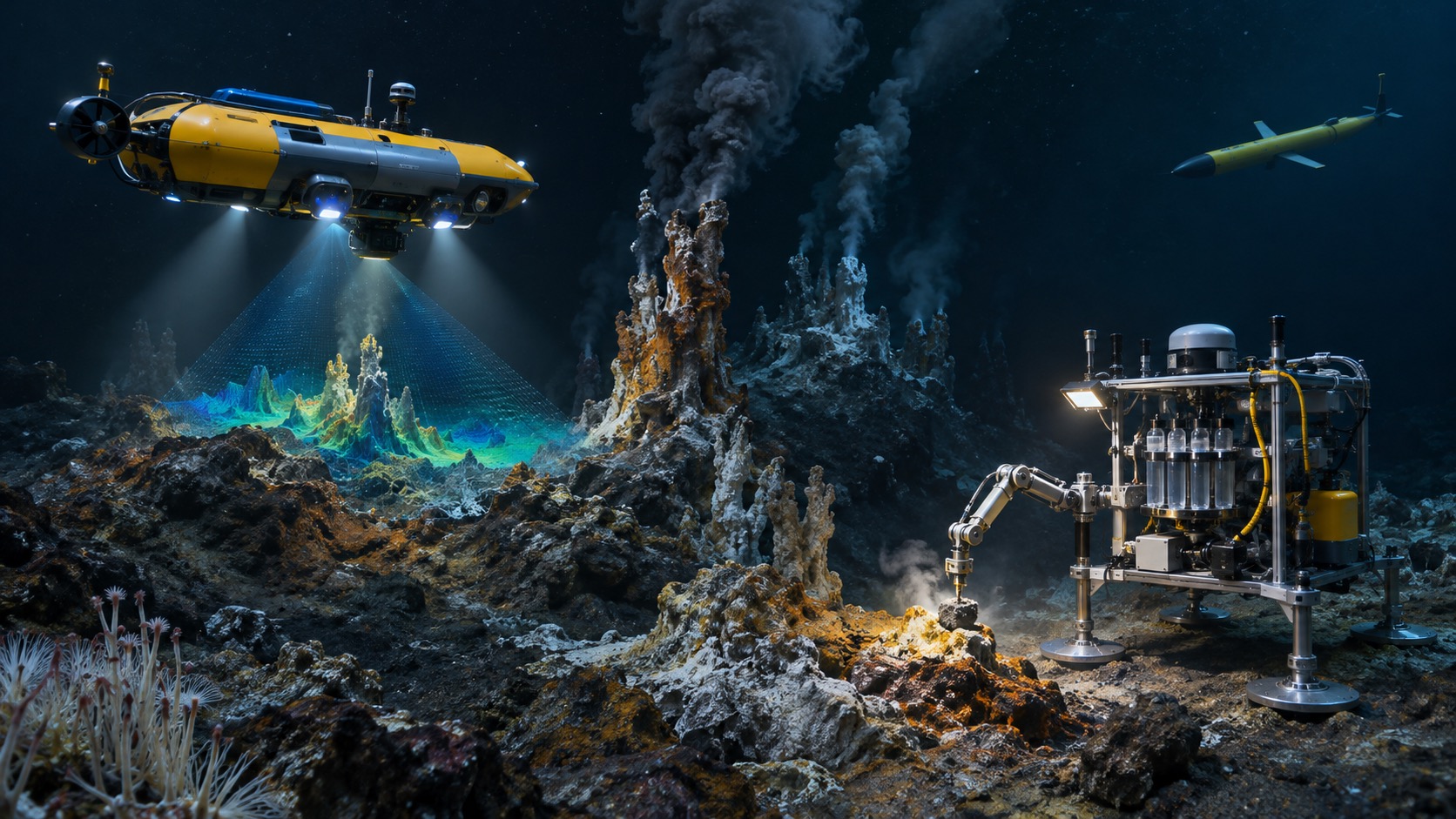
Sonar sends sound and measures echoes. Multibeam systems map depth across a swath. Side-scan sonar images texture and objects across the seabed. Imaging sonar supports close navigation in murky water, while sub-bottom instruments probe sediment layers. Resolution depends on frequency, range, angle, and motion.
Shadows can reveal object shape but also hide features. Specialists correct vehicle position and interpret acoustic images; a bright return is not automatically a specific object.
Cameras Still Provide Essential Context
Visible cameras identify species, corrosion, damage, sediment, and human-made objects. Lights restore color lost with depth, but they also illuminate suspended particles that scatter back toward the lens. Operators place lights away from the camera and approach slowly. Low-light cameras reduce illumination needs, and stereo systems estimate scale. Video records only the field of view, so survey paths and camera angle matter. Color calibration and reference scales make scientific images more useful than dramatic footage alone.
Sensors Measure the Water Itself
Oceanographic payloads measure temperature, conductivity, salinity, pressure, oxygen, acidity, turbidity, chlorophyll, nutrients, currents, and traces of chemicals. Calibration, sensor response time, and vehicle flow affect readings. A sensor mounted near a thruster may sample disturbed water. Biofouling gradually coats instruments during long deployments.
Teams use cleaning systems, reference samples, and pre- and post-mission calibration. Location and time connect every measurement with the changing water mass.
Manipulators Let Robots Touch the Seafloor
ROV arms collect rocks, organisms, sediment, and instruments; turn valves; cut lines; and place tools. Underwater manipulation is difficult because currents move the vehicle and video compresses depth. Force feedback, multiple cameras, and stable hovering help. Samples need containers and custody. A precise grab without context can damage habitat or lose scientific meaning. Pilots work with scientists or engineers who select targets and document orientation before contact.
Power Shapes Every Mission
Tethered ROVs may receive continuous surface power. Independent vehicles rely on batteries, fuel cells, buoyancy engines, or harvested solar, wind, and wave energy at the surface. Propulsion often dominates consumption, followed by computing, lights, sonar, and heaters. Cold reduces battery performance.
Mission software reserves energy for ascent, communication, and recovery rather than spending everything on survey coverage. Charging and battery handling aboard ships require fire protection and trained procedures. Endurance claims are meaningful only with the intended payload, speed, current, and temperature.
Launch and Recovery Are Often the Riskiest Moments
A vehicle that operates calmly at depth may be damaged beside a rolling ship. Cranes, frames, lines, and trained deck crews move it through waves. Small robots can launch from shore, but surf and rocks remain hazardous. Recovery needs a detectable position, lifting point, and plan for lost propulsion. Weather limits may end a mission early. Teams protect people first; no dataset justifies unsafe deck work.
Common Missions Range From Science to Infrastructure
Researchers map habitats, count organisms, study currents, sample vents, and observe seasonal change. Industries inspect pipelines, cables, dams, turbines, platforms, ships, and aquaculture. Public agencies search for objects, survey hazards, and monitor water quality. Archaeologists document submerged sites.
The same platform may serve several missions with different payloads, but every configuration changes balance, endurance, and data quality. Success is defined by a useful measurement or completed task, not distance traveled underwater.
Beginners Should Think in Complete Mission Cycles
An underwater robot is one part of a system that includes transport, support vessels, operators, navigation references, weather decisions, data processing, maintenance, and recovery. A technically capable vehicle can fail if its files lack position or its launch system cannot handle expected waves. Start with the question, choose the simplest platform that can reach and measure it, test in controlled water, and define lost-vehicle behavior. Ocean access becomes dependable through disciplined preparation rather than confidence in hardware alone.
Data Quality Is Part of Vehicle Design
A robot can complete its route and still produce weak evidence if vibration blurs images, timing drifts, sonar altitude changes, or a sensor samples water disturbed by thrusters. Scientists and inspectors therefore design the vehicle, payload, route, and processing method together. Mounting position protects the measurement from electrical noise, magnetic fields, bubbles, heat, and flow generated by the machine.
Calibration records connect readings with traceable references. Navigation uncertainty travels with every mapped feature rather than disappearing when software draws a clean line.
Teams also preserve original files, configuration, time synchronization, and processing steps so another analyst can reproduce the result. These practices may seem separate from robotics, but they determine whether underwater access becomes useful knowledge. A reliable platform is not merely one that returns to the surface. It returns observations whose location, scale, limits, and history remain clear enough to support a scientific, engineering, or safety decision.
Training Water Builds Reliable Teams
Pools, quarries, sheltered bays, and instrumented test tanks let teams learn without the full cost and risk of open water. Operators practice buoyancy, trim, tether handling, sonar interpretation, manipulator control, and recovery. Scientists verify that sampling containers and sensor timing match the mission question. Exercises should include realistic faults: a weak thruster, obscured camera, acoustic dropout, leaking connector alarm, or missed recovery approach. The team learns when to continue, simplify, or abort. Deck crew rehearse lifting and securing the vehicle while communication remains concise.
Controlled tests cannot reproduce deep pressure, ocean current, or ship motion, but they expose basic integration failures early. Reliable underwater work grows from progressive trials that increase depth, duration, payload, and environmental difficulty only after the earlier configuration is understood.
Good Missions End With Usable Evidence
After recovery, teams rinse and inspect the vehicle, copy data, verify clocks, document faults, and connect every record with navigation and calibration. That disciplined closeout turns underwater travel into evidence another person can understand and trust.
One Final Beginner Rule
Never launch without naming who will stop the mission and who will recover the vehicle.
Decide where the recovered data will be secured before the robot enters the water.